- Главная
- Разное
- Дизайн
- Бизнес и предпринимательство
- Аналитика
- Образование
- Развлечения
- Красота и здоровье
- Финансы
- Государство
- Путешествия
- Спорт
- Недвижимость
- Армия
- Графика
- Культурология
- Еда и кулинария
- Лингвистика
- Английский язык
- Астрономия
- Алгебра
- Биология
- География
- Детские презентации
- Информатика
- История
- Литература
- Маркетинг
- Математика
- Медицина
- Менеджмент
- Музыка
- МХК
- Немецкий язык
- ОБЖ
- Обществознание
- Окружающий мир
- Педагогика
- Русский язык
- Технология
- Физика
- Философия
- Химия
- Шаблоны, картинки для презентаций
- Экология
- Экономика
- Юриспруденция
Labeling the map презентация
Содержание

Слайд 2Objectives of our lesson:
understand specific information in extended talk;
recognise the opinion
of the speaker; put the following labels on a map;
to understand and distinguish specific information about Kazakhstan;
to understand and distinguish specific information about Kazakhstan;

Слайд 3
Half of the class are given questions and half are given
answers.
You must silently go around the room trying to find out who their partner is. Could also be done with them talking and the questions and answers being stuck on your backs to make it a bit more challenging.
You must silently go around the room trying to find out who their partner is. Could also be done with them talking and the questions and answers being stuck on your backs to make it a bit more challenging.


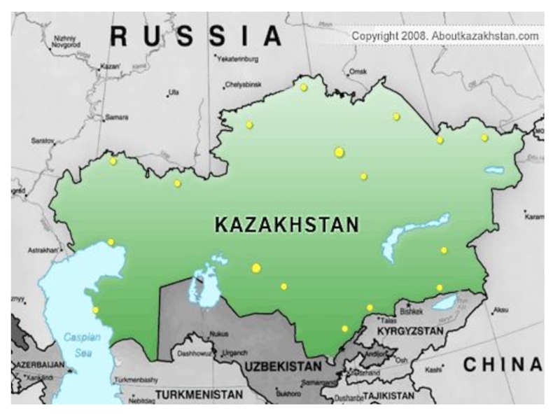
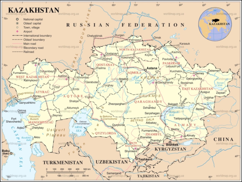
Слайд 5 This is a map of Kazakhstan. It shows cities and towns.
We can also see that Kazakhstan is connected to other places in the world. Rivers and seas help people travel to and from Kazakhstan. Russia is the country to the north. Uzbekistan is the country to the south. This section will explore the geography of Kazakhstan.

Слайд 7Vocabulary
Shrub- куст semi-desert -полупустыни,
Pastures -пастбища, shrubbery-
кустарник mountainous- горный
Glaciers -ледник, limestone-известняк ,
plateau -плато, arid- засушливый,
wetlands-заболоченный,
Swamps- болота, meadow- луг,
mountain range –горная цепь,
vegetation- растительность ,
Glaciers -ледник, limestone-известняк ,
plateau -плато, arid- засушливый,
wetlands-заболоченный,
Swamps- болота, meadow- луг,
mountain range –горная цепь,
vegetation- растительность ,