- Главная
- Разное
- Дизайн
- Бизнес и предпринимательство
- Аналитика
- Образование
- Развлечения
- Красота и здоровье
- Финансы
- Государство
- Путешествия
- Спорт
- Недвижимость
- Армия
- Графика
- Культурология
- Еда и кулинария
- Лингвистика
- Английский язык
- Астрономия
- Алгебра
- Биология
- География
- Детские презентации
- Информатика
- История
- Литература
- Маркетинг
- Математика
- Медицина
- Менеджмент
- Музыка
- МХК
- Немецкий язык
- ОБЖ
- Обществознание
- Окружающий мир
- Педагогика
- Русский язык
- Технология
- Физика
- Философия
- Химия
- Шаблоны, картинки для презентаций
- Экология
- Экономика
- Юриспруденция
Презентация " Geographical Pecularities of the UK" презентация
Содержание
- 1. Презентация " Geographical Pecularities of the UK"
- 2. British
- 3. The official name of the country The
- 4. Capital cities of the UK London
- 5. Britain is washed by: the Atlantic Ocean
- 6. Surface of Britain Some parts of Great
- 7. Mountains in Britain In the west of
- 8. Rivers of Britain There are many
- 9. Lake District The Lake District, also commonly
- 10. Lake District
- 11. The Scottish lakes In
- 12. Britain's the largest freshwater lake Lough Neagh,
- 13. The area of Great Britain is
- 14. Great Britain is a highly developed capitalist
- 15. Check yourself DO YOU KNOW THE
- 16. Answer the questions:
Слайд 2 British Isles
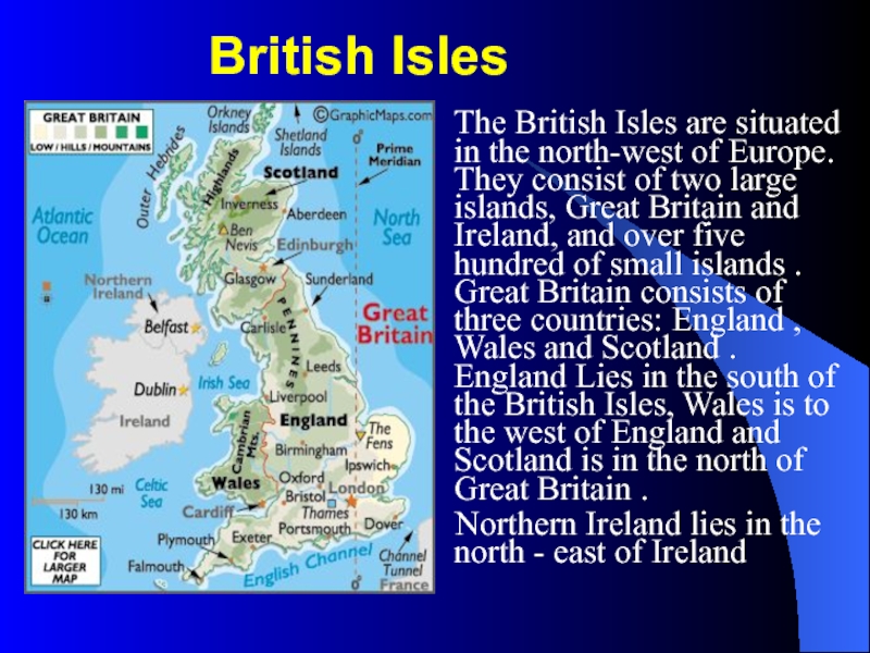
The British Isles
are situated in the north-west of Europe. They consist of two large islands, Great Britain and Ireland, and over five hundred of small islands . Great Britain consists of three countries: England , Wales and Scotland . England Lies in the south of the British Isles, Wales is to the west of England and Scotland is in the north of Great Britain .
Northern Ireland lies in the north - east of Ireland
Northern Ireland lies in the north - east of Ireland
Слайд 3The official name of the country
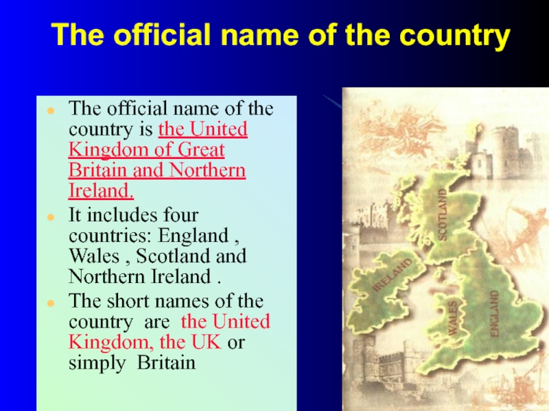
The official name of the country
is the United Kingdom of Great Britain and Northern Ireland.
It includes four countries: England , Wales , Scotland and Northern Ireland .
The short names of the country are the United Kingdom, the UK or simply Britain
It includes four countries: England , Wales , Scotland and Northern Ireland .
The short names of the country are the United Kingdom, the UK or simply Britain
Слайд 4 Capital cities of the UK
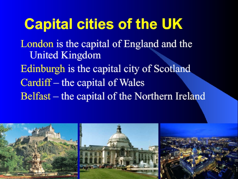
London is the capital of England
and the United Kingdom
Edinburgh is the capital city of Scotland
Cardiff – the capital of Wales
Belfast – the capital of the Northern Ireland
Edinburgh is the capital city of Scotland
Cardiff – the capital of Wales
Belfast – the capital of the Northern Ireland
Слайд 5Britain is washed by:
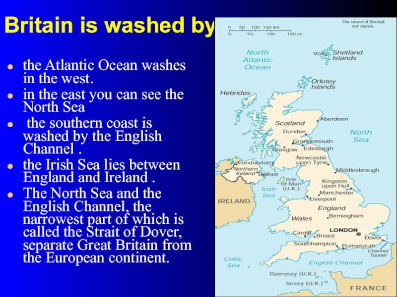
the Atlantic Ocean washes in the west.
in
the east you can see the North Sea
the southern coast is washed by the English Channel .
the Irish Sea lies between England and Ireland .
The North Sea and the English Channel, the narrowest part of which is called the Strait of Dover, separate Great Britain from the European continent.
the southern coast is washed by the English Channel .
the Irish Sea lies between England and Ireland .
The North Sea and the English Channel, the narrowest part of which is called the Strait of Dover, separate Great Britain from the European continent.
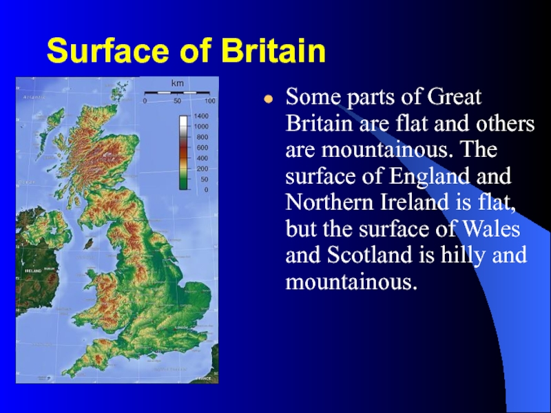
Слайд 6Surface of Britain
Some parts of Great Britain are flat and others
are mountainous. The surface of England and Northern Ireland is flat, but the surface of Wales and Scotland is hilly and mountainous.
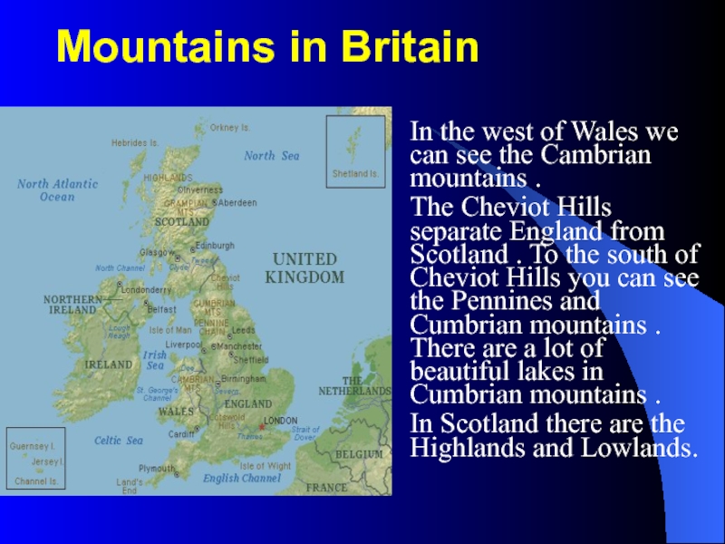
Слайд 7Mountains in Britain
In the west of Wales we can see the
Cambrian mountains .
The Cheviot Hills separate England from Scotland . To the south of Cheviot Hills you can see the Pennines and Cumbrian mountains . There are a lot of beautiful lakes in Cumbrian mountains .
In Scotland there are the Highlands and Lowlands.
The Cheviot Hills separate England from Scotland . To the south of Cheviot Hills you can see the Pennines and Cumbrian mountains . There are a lot of beautiful lakes in Cumbrian mountains .
In Scotland there are the Highlands and Lowlands.
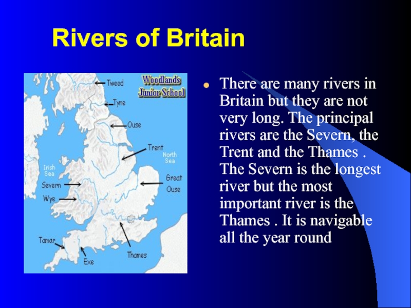
Слайд 8Rivers of Britain
There are many rivers in Britain but they
are not very long. The principal rivers are the Severn, the Trent and the Thames . The Severn is the longest river but the most important river is the Thames . It is navigable all the year round
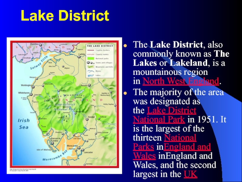
Слайд 9Lake District
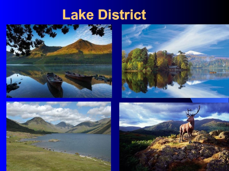
The Lake District, also commonly known as The Lakes or Lakeland, is a
mountainous region in North West England.
The majority of the area was designated as the Lake District National Park in 1951. It is the largest of the thirteen National Parks inEngland and Wales inEngland and Wales, and the second largest in the UK
The majority of the area was designated as the Lake District National Park in 1951. It is the largest of the thirteen National Parks inEngland and Wales inEngland and Wales, and the second largest in the UK
Слайд 11 The Scottish lakes
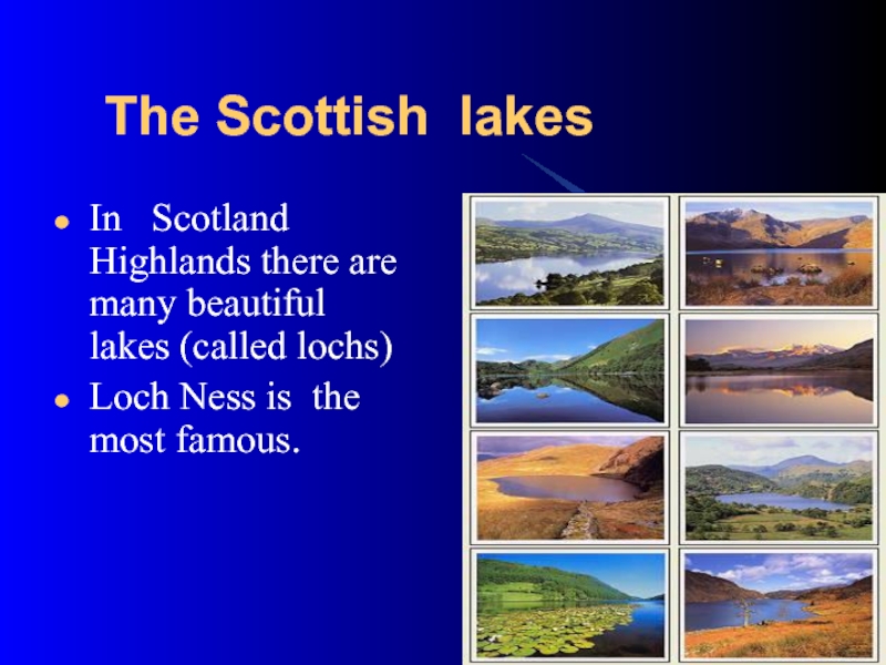
In Scotland Highlands there are many
beautiful lakes (called lochs)
Loch Ness is the most famous.
Loch Ness is the most famous.
Слайд 12Britain's the largest freshwater lake
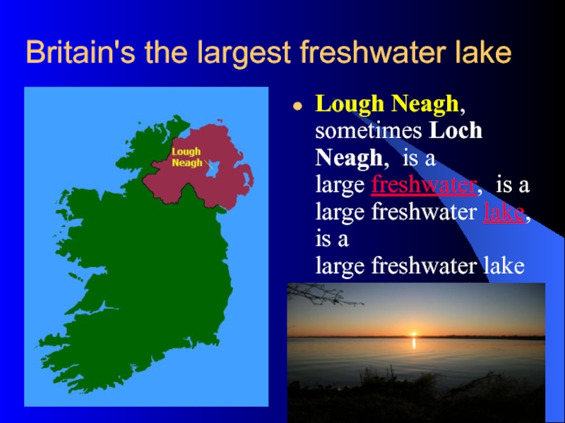
Lough Neagh, sometimes Loch Neagh, is a large freshwater,
is a large freshwater lake, is a large freshwater lake in Northern Ireland. It is the largest lake in Britain
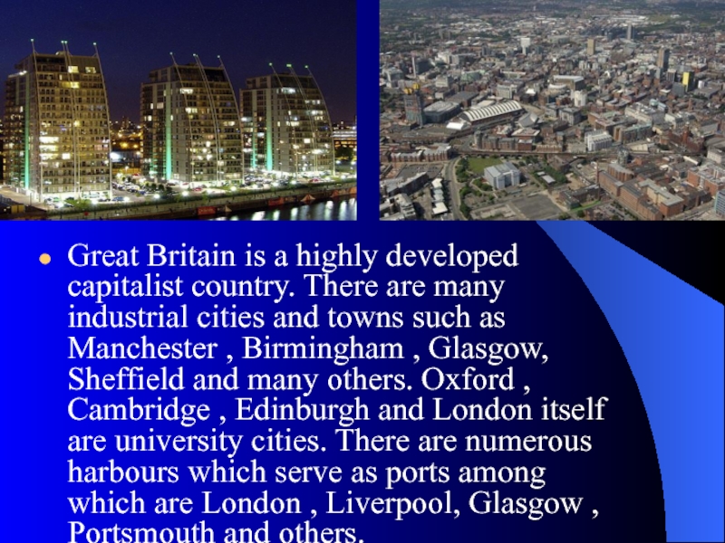
Слайд 14Great Britain is a highly developed capitalist country. There are many
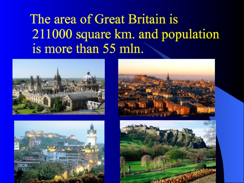
industrial cities and towns such as Manchester , Birmingham , Glasgow, Sheffield and many others. Oxford , Cambridge , Edinburgh and London itself are university cities. There are numerous harbours which serve as ports among which are London , Liverpool, Glasgow , Portsmouth and others.
Слайд 15Check yourself
DO YOU KNOW THE DIFFERENCE AMONG
BRITISH ISLES
GREAT BRITAIN
THE UNITED KINGDOM OF GREAT BRITAIN AND NOTHERN IRELAND?
Слайд 16 Answer the questions:
• What do we call a
group of islands situated to the northwest of Europe ?
• What are the names of the two biggest islands?
• What parts does Great Britain consist of?
• Where is each part situated? ( England , Wales , Scotland ).
• What are the most important rivers in Great Britain ?
• Why is the Thames the most important river?
• Are there many mountains and hills in Great Britain ?
• What are the names of the mountains?
• What is the area (the population) of Great Britain ?
• What country is Great Britain ?
• What industrial (university) cities of Great Britain do you know?
• Why are there many ports in Great Britain ?

